


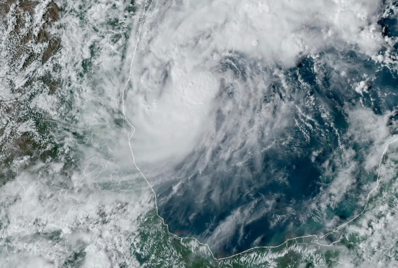
Tropical Storm Milton, currently located in the Gulf of Mexico, has intensified over the weekend and is anticipated to reach hurricane status later today, according to the National Hurricane Center (NHC). An advisory issued Sunday morning at 9 a.m. EST confirmed the storm’s escalating strength, following data from a National Oceanic and Atmospheric Administration (NOAA) aircraft.
The NHC has raised concerns about “life-threatening impacts” for parts of the Florida West Coast as Milton continues to strengthen. A “Tropical Storm Watch” is now in effect for the Mexican coast, stretching from Celestun to Cancun. Additionally, the Yucatán Peninsula, Florida, the Florida Keys, and the northwestern Bahamas should remain vigilant as interests across these areas could be affected.
As the situation evolves, hurricane and storm surge watches may be issued for various regions in Florida later today. In response to the approaching storm, Florida Governor Ron DeSantis declared a State of Emergency for 35 counties on Saturday. This declaration has since been expanded to include 51 counties, acknowledging the potential impact of Milton on communities still recovering from the recent devastation of Hurricane Helene.
In a press conference Sunday morning focused on disaster preparedness, DeSantis emphasized the importance of managing debris from Hurricane Helene in anticipation of Milton’s arrival. He urged residents to prioritize their preparations throughout the remainder of the weekend and into the upcoming week. “We are using every resource at our disposal to help our local communities to get the debris out…this is all hands on deck,” DeSantis stated, adding, “This is not a good track for the state of Florida.”
As of early Sunday, the center of Milton was moving slowly eastward and is expected to accelerate across the Gulf of Mexico, ultimately reaching the west coast of Florida later this week. The storm’s winds have increased to 60 mph, with its eye located approximately 850 miles west-southwest of Tampa, Florida.
Rainfall estimates for Florida range from 5 to 8 inches, with localized totals potentially reaching up to 12 inches through Wednesday night, raising concerns for flash, urban, and areal flooding. In contrast, Mexico is forecasted to receive lesser amounts of rainfall, estimated at 2 to 4 inches across the Yucatán and Cuba. Furthermore, dangerous surf swells are expected along much of the Gulf Coast, which could result in life-threatening surf and rip current conditions. Residents are advised to stay updated on the storm’s progress and heed local warnings as the situation develops.